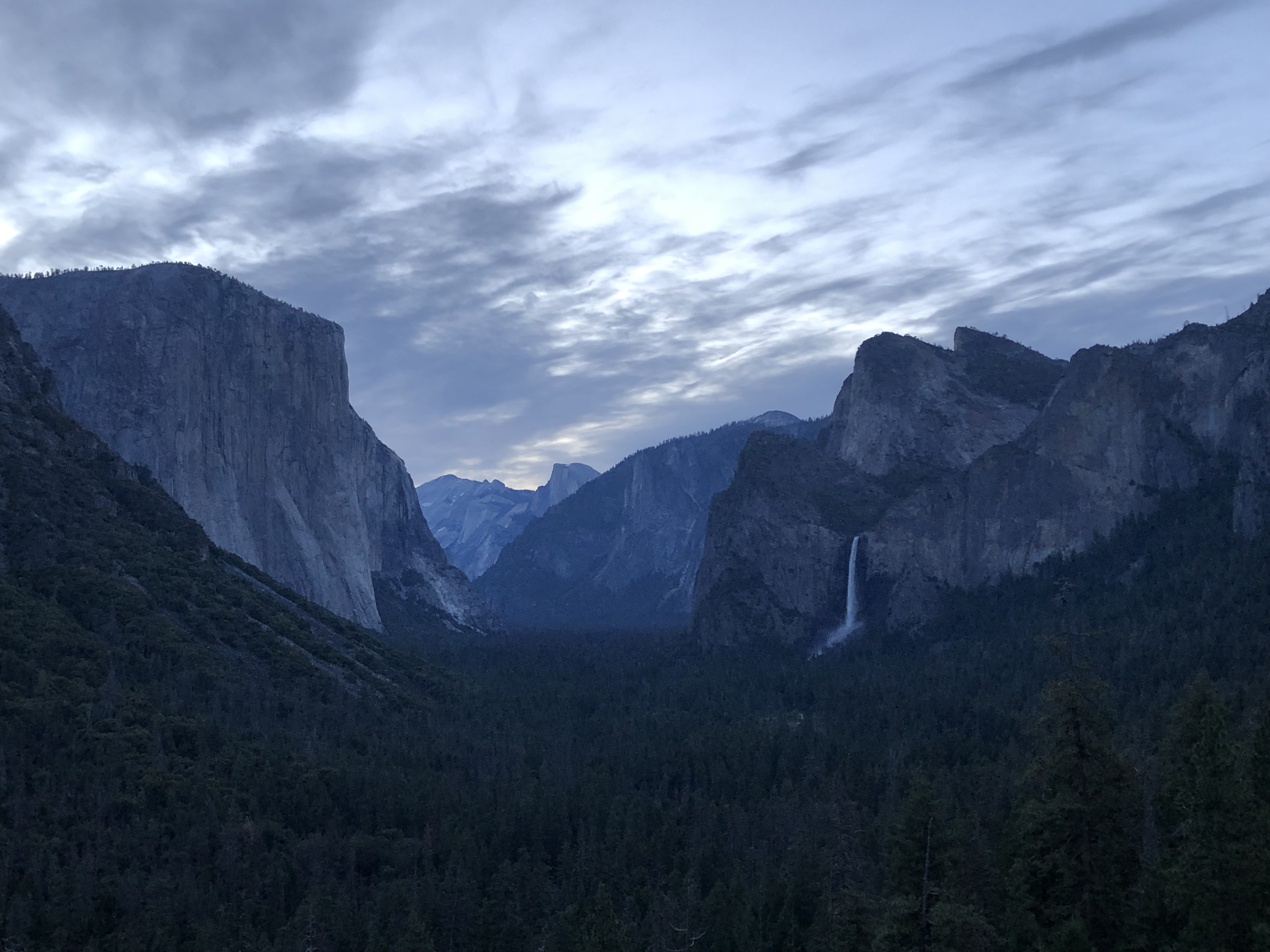
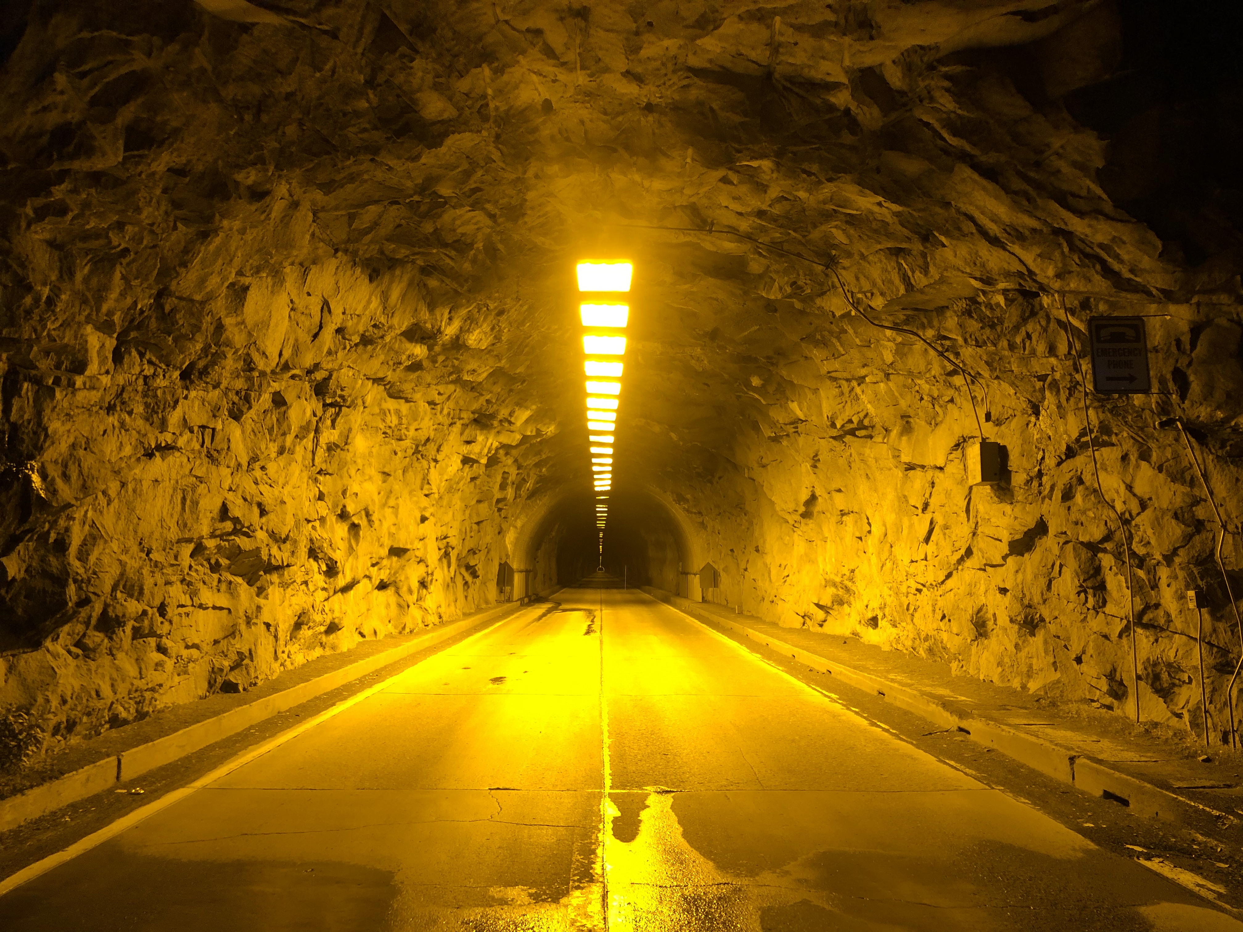
On my group’s second day, we decided to drive up to Glacier Point. It’s reached by a road that branches off of highway CA-41, which enters Yosemite Valley from the south. We drove in from an AirBnB at Wawona so we didn’t have to pass through the valley, but drivers coming in from CA-120, CA-140, or the valley itself will have to take a branch off that takes you out of the valley through the long, straight Wawona tunnel. Just before the tunnel, there’s a parking lot at Tunnel View, which also has an overlook of the valley. I went there with another group for sunrise a couple of weeks prior. It turned out to not be a great spot to watch, however, because the sky gets lighter much earlier than the sun itself rises above the valley walls. So while it was pleasant to watch the valley and its landmarks appear in shades of muted blues and grays, you may not see as many of the orange and red hues that usually accompany a sunrise. We took advantage of our early start, and stopped by a couple other Yosemite Valley landmarks before driving back to our AirBnB for some rest. The empty roads and parking lots were a stark contrast to the traffic jam we’d had to wade through the previous day, and we were grateful to not have to do it again.


Back to Glacier Point, it takes about an hour one-way to get there from the valley floor. There’s a sizable parking lot at the end of the road, though I imagine it can fill up and there’s no nearby alternate option for parking if it does. We secured a spot shortly after 9 a.m., and cars were circling and waiting for spots by the time 10 a.m. rolled around. So, 9 a.m. is the benchmark you should shoot for on a weekend if you want a spot at Glacier Point, based on my data point.
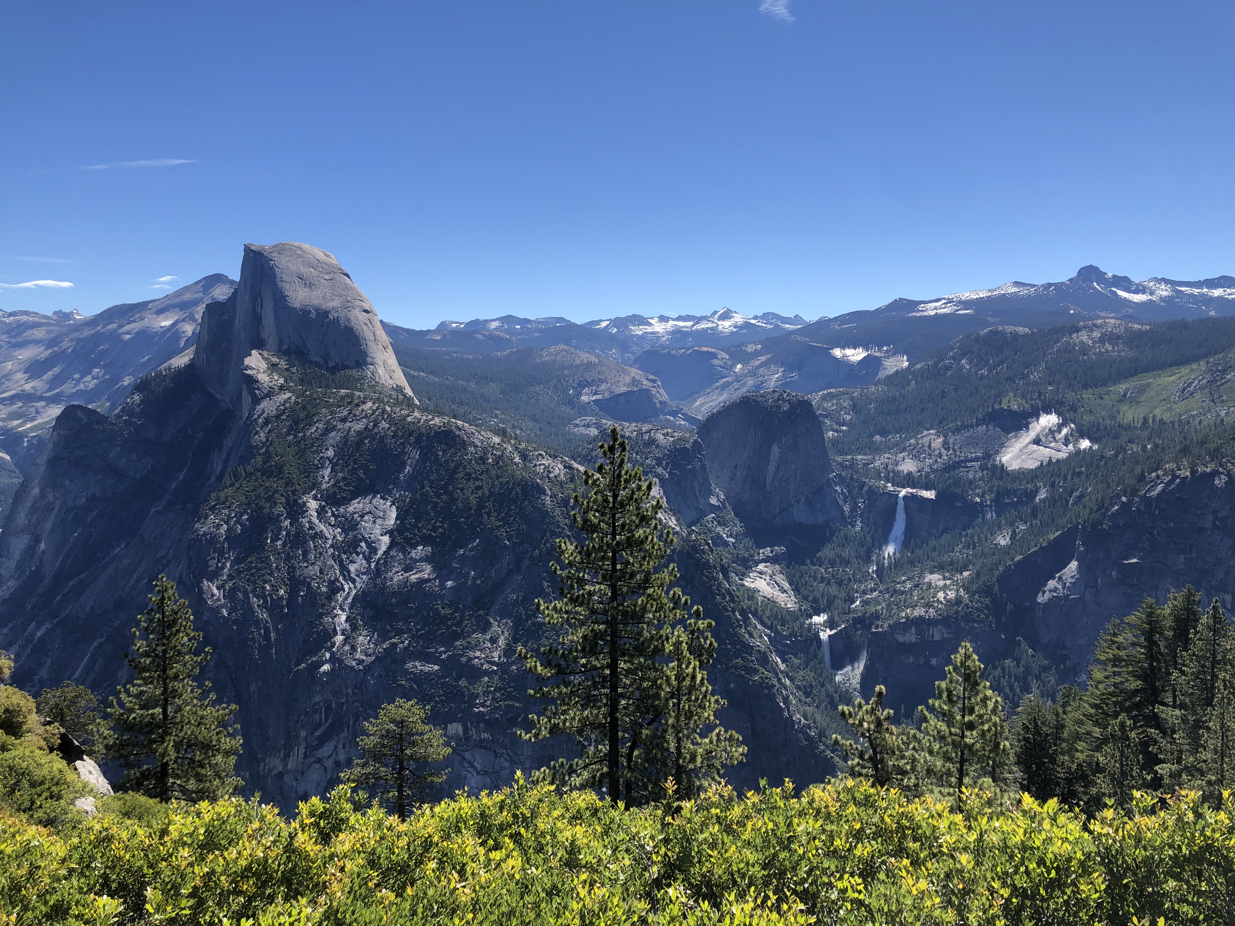
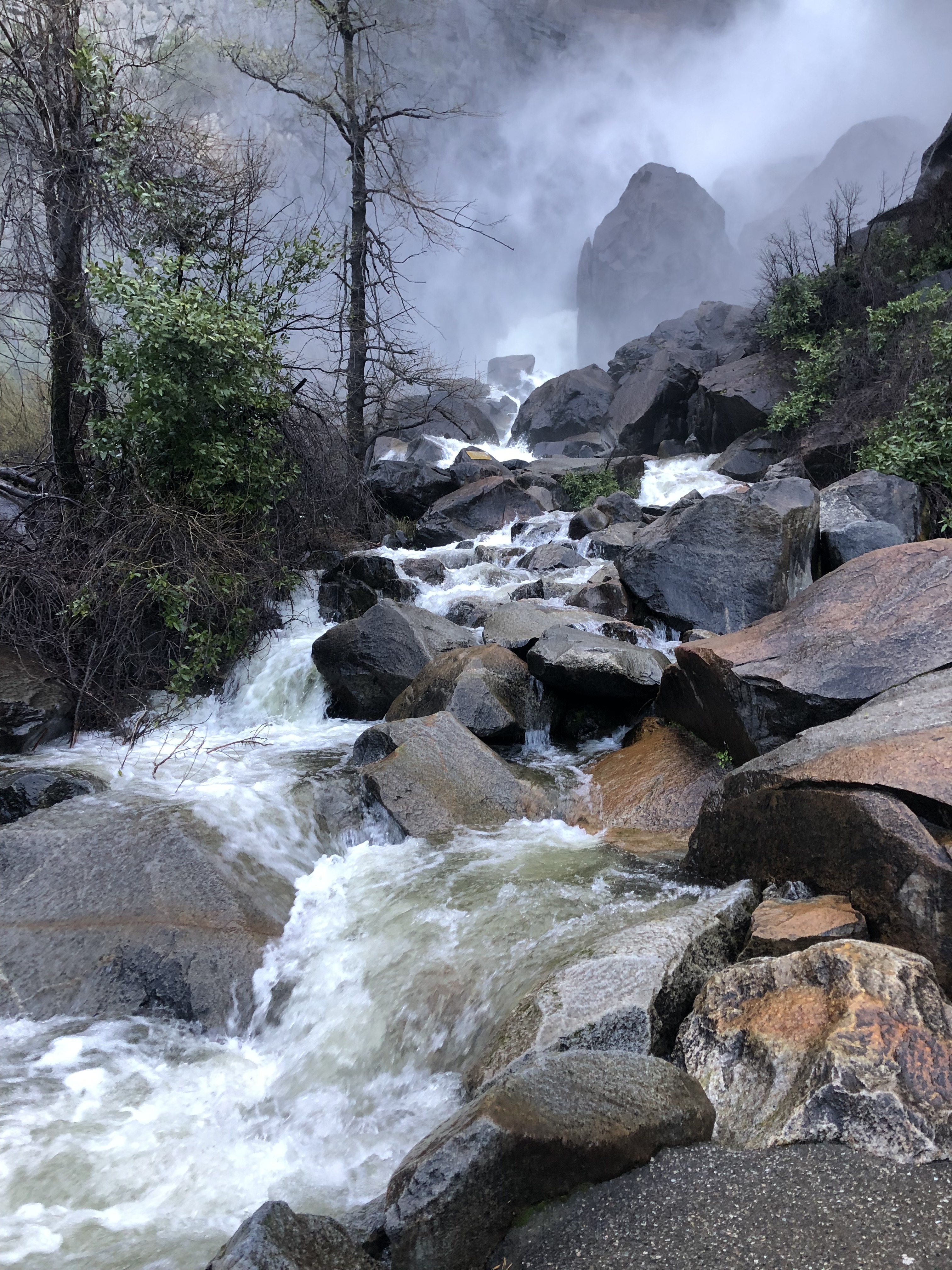
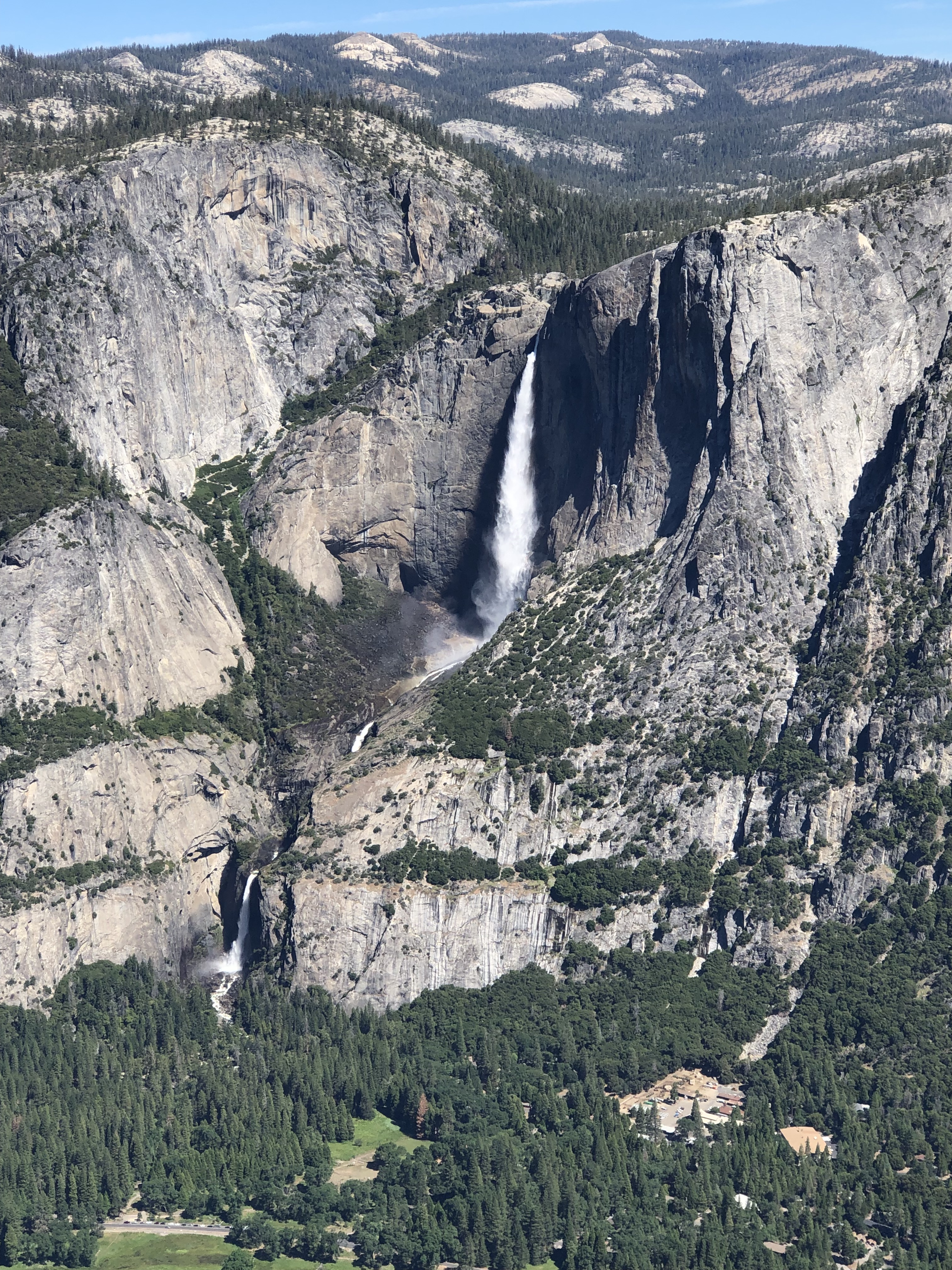
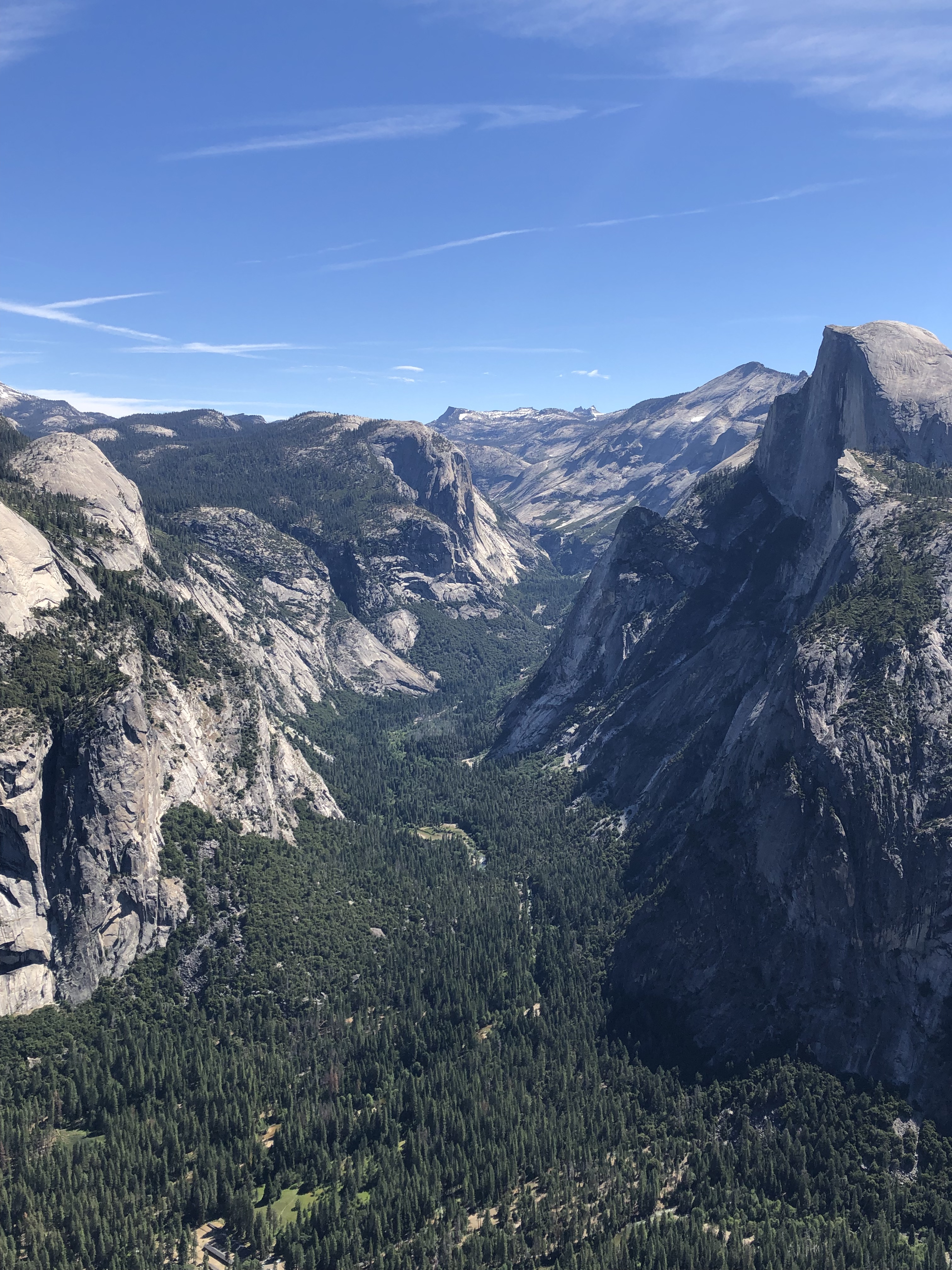
There are a few trails that stem from Glacier Point, including one dropping over 3,000 feet to the valley floor. However, we planned to hike on a less trafficked trail and just went to the viewpoint. What you’ll see one-by-one as you drive through the valley, you’ll see all that and more from Glacier Point itself! The valley floor stretches out below you, beyond a sheer, staggering drop. El Capitan is less recognizable from here, so your first landmark to the left will be Yosemite Falls. From this vantage point, both the upper and lower falls are clearly visible in all their splendor. You can look straight below to the valley itself, where you’ll see its lush, green meadows. Further east, you’ll see the meadows replaced by trees as the valley floor rises steadily. Overlooking this part of the valley is Half Dome, which is the most recognizable Yosemite landmark from the air. Far beyond Half Dome is Cloud’s Rest, which is much harder to make out. In the far right of the viewpoint, Vernal and Nevada Falls come into view, which are the two waterfalls that we’d hiked up the previous day. Being able to see the entirety of the trails we’d taken yesterday all at once, suddenly gave us a scale of how little of Yosemite we’d actually hiked through. It also became more clear how crazy steep some of the sections of trails were that led up the side of the falls. Because you can see everything at once, I’d actually recommend this as the starting point of a Yosemite trip, especially for anyone coming south of the valley. If you’re willing to be a super early bird, I think a sunrise here would be spectacular. Once you’d gotten a chance to take in the sheer scale and beauty of the valley, you could meander down there by car and still arrive before there’s fierce competition for parking spaces. Also note that the Glacier Point road closes down during the snowy season, which can start as early as October and last as late as May.


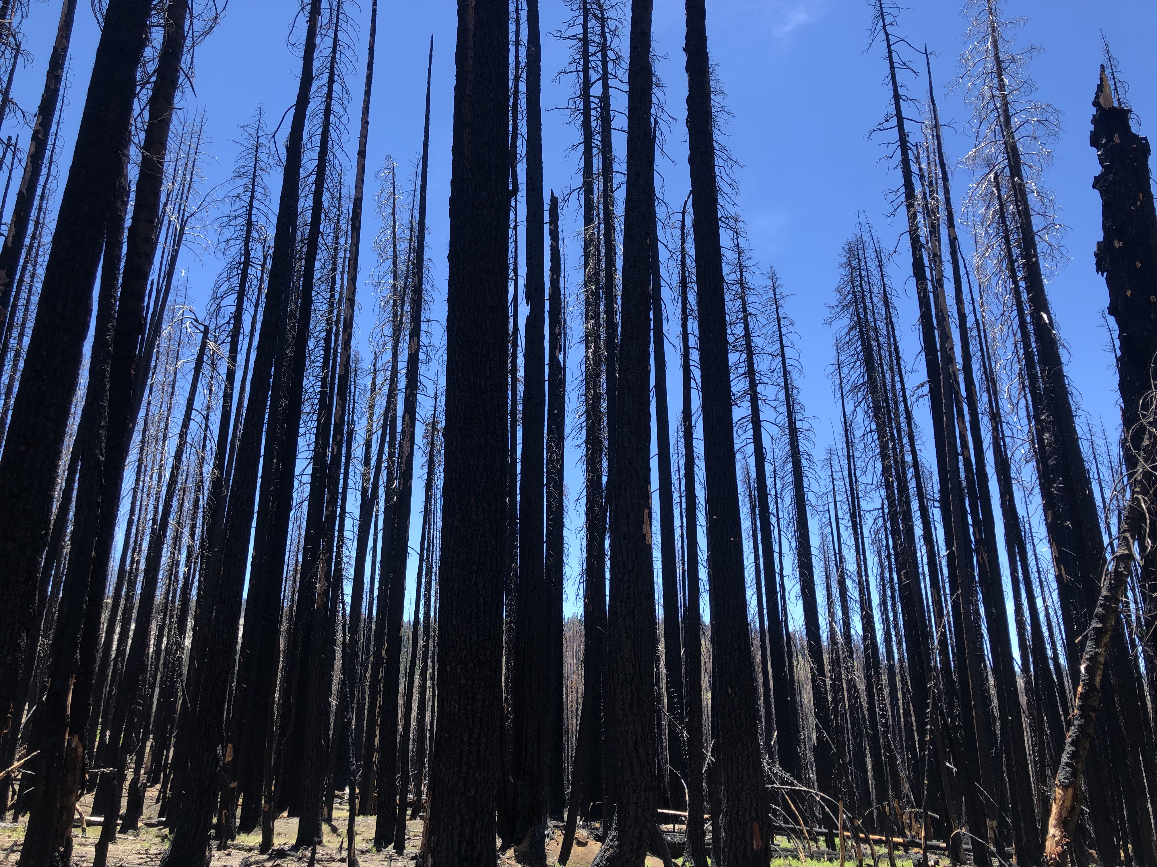
Afterwards, we chose to do the hike to Ostrander Lake. It’s a 12 mile roundtrip, but doesn’t come with steep sections or intense elevation gain. However, there’s also less to see along the way. We had some alpine meadows and grassy forests, but that’s about the extent of it. A little more than halfway along, we also got to the burned out husk of a former forest. Seeing that we still had a long way to the lake, we decided to call it a day and turn around. Based on what we saw, I definitely wouldn’t put this hike at the top of any Yosemite list. Maybe that changes if you go all the way to the lake though, especially since you’d have it mostly to yourselves. The trail is off the beaten path, which is mostly why we picked it, so it could still be a side option if the parking lot at Glacier Point fills up, or you want to avoid crowds.